The road ends at Rhenigidale, but the haunting beauty of the area & the social life in the hostel takes over.
Going Up
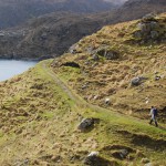 The population of the Western Isles declined by 9.9% during the 30 years from 1981 – 2011. However, during the last ten years of that period, it increased by 4.5%. This trend is reflected in Rhenigidale where the number of residents fell to 11 by the late 1980s. However, with the coming of the road Read More ...Read More »
The Original Way
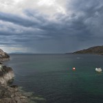 The word ‘remote’ is often used to describe Rhenigidale – for it is approached by a long single-track road from the junction on the A859 or by an arduous walk from the Scalpay – Tarbert road. However, throughout most of its occupation people and goods came by sea. This bay was once busy with small Read More ...Read More »
Robert Macfarlane
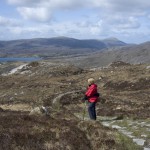 Robert Macfarlane, an acclaimed travel writer, has produced Mountains of the Mind, The Wild Places and The Old Ways; A Journey On Foot. This is an extract from an article of his in the Financial Times: ‘From Rhenigidale, the track contours audaciously above steep-sided sea-coves, marked with rust-lines of seaweed. Raised stripes of feannagan (lazy beds) Read More ...Read More »
Cosy in Crofters' Hostel
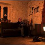 There is something cosy and attractive about the glow from the stove at Rhenigidale, photographed here by Gareth Harper. The winter weather can be bracing and the conditions somewhat bleak, but once the kindling is set alight and the coal ignites, then the common room becomes increasingly welcome. Add that other great Gatliff ingredient, company, Read More ...Read More »
Reciprocal Views?
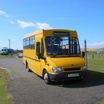 Early this month there was an item on how an American visitor to Rhenigidale travelled on the same school bus and was slightly bemused by the normal attitude of the three schoolchildren on board who paid no attention to him, being understandably absorbed with their smartphone connections. A fourth child, who has often travelled that Read More ...Read More »
'Insignificant Village'
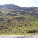 A blog by Diamond Geezer features Rhenigidale and describes it as ‘the insignificant village’. The piece was written in 2006 and looks back to the 1980s and beyond. The walk there has often been the subject of many items in the press and on the internet, but it’s the image of a Cove on Loch Trollamaraig (not the photograph Read More ...Read More »
A Best Wild Place
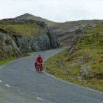 Christopher Somerville’s book Britain and Ireland’s Best Wild Places: 500 Essential Journeys was published some three years ago, but certain factors do not date. Jonny Muir’s review in The Ecologist mentions the inclusion of Rhenigidale. To many hostellers this, the setting of the oldest of the three existing Gatliff hostels, particularly deserves a mention – Read More ...Read More »
Ways and Means
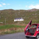 There are several different ways of getting to and from Rhenigidale. People will devise approaches and write about them. Some wanted to be brought by their Isetta which they had named ‘Soapy’. Another wanted to incorporate the hostel in a walk taking in a range of local places seldom visited. For the former, enjoy the Read More ...Read More »
Final Phone Pursuits
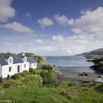 Here’s an extract from Secret Scotland Forum: ‘It wasn’t the last manual telephone – it was ‘Rhenigidale 1’ in the village of Rhenigidale on the Isle of Harris which didn’t get a road connection until the early 1990s. With the coming of the road, BT laid a cable to Rhenigidale and on 5 March 1990, the Read More ...Read More »
Former Townships
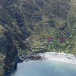 Previous blogs have encouraged visitors to Rhenigidale to continue exploring by walking over the hill, not around the coast, to Molinginish. The Northern Trip site gives plenty of background to the once small, but flourishing, settlement that is now a holiday home. Interesting information is also carried about the 36 townships which were to be Read More ...Read More »
Google Map
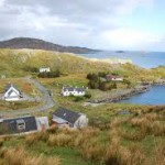 Google captures both urban and rural with its street views and maps. Here’s the Rhenigidale perspective as presented by WikiMapia – with some added photographs taken by interested parties of places of interest within the community. There is something compelling that a forgotten settlement was revived by a road, with European funding, and is now Read More ...Read More »
Schools Hebridean Society
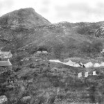 The Schools Hebridean Society had a short, but eventful history. A significant number of school-pupils took part in camping expeditions to various islands and some of these adventurous spirits have maintained contact with the Scottish islands. Aspects of the history of the Society appeared in a series of articles in Scottish Islands Explorer magazine and Read More ...Read More »
Rainbow to Rhenigidale
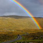 Now here’s a blog that was hoisted into cyberspace – rather like this rainbow – on 1 November last. It’s the work of Ken Ilgunas, who describes himself as a former cart-pushing New York suburbanite turned Alaska-inspired, Thoreau-style traveller. Read what he says, particularly about his walk, stay and ride out of Rhenigidale on the Read More ...Read More »
Arithmetic Lesson
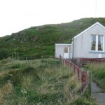 The decline in island population numbers during the first half of the last century is well-illustrated in the answer, involving a series of place-names and figures, to a parliamentary question – reported in Hansard in December 1960. There was, for example, a 50% reduction at Rhenigidale during that time. However, two facts should be stated. Read More ...Read More »
Go Off-Grid?
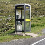 Some 18 months ago a journalist wrote a piece for The Guardian about settlements without wi-fi, mobile or television connections. Among the places he located was Rhenigidale. The telephone was a long time coming, but once it arrived there was a difference. It was via a radio link to Skye rather than by telephone lines Read More ...Read More »
Still Active
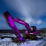 Among Gatliff visitors are those who cruise to Rhenigidale by road and those who use the Path. Then there are those who recall the days when there was no road. It is a construction of the 1980s with European Community funding that ceased for a while. However, the route migrated from a construction site to Read More ...Read More »
Warmth in Winter
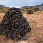 Earlier this year Cody Duncan visited Rhenigidale, with his camera, and returned with some remarkable winter images of Luskentyre, peat cutting fields and of the hostel. His website and blog are worth visiting for they indicate how much he enjoyed his stay there – in January. The stove at the hostel is fuelled by wood Read More ...Read More »
Go On, Blog
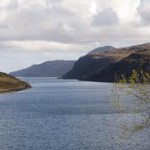 Take a look at the blog, The Road North – with its text and images – by Ken Cockburn. It considers aspects of his stay on Harris, with an emphasis in and around Rhenigidale. Why not undertake similar yourself? The log-books at the hostel have comments by visitors; the blogs appearing on the internet have Read More ...Read More »
Cold ... and Compelling
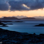 The photograph by Roderick Read is from a vantage point above Rhenigidale on a cold day. It is a reminder that although the settlement is at sea level and, therefore, reasonably temperate, the heights of the hills around brings exposure to lower temperatures. His gallery and, in particular, the samples of work on either side include a Read More ...Read More »
Moon Over The Minch
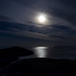 The hours of daylight are restricted during the winter months in the North of Scotland. This photograph taken by Julian Devine from the shore at Rhenigidale indicates something of the sensations that can be, and were, experienced there. Many journeys by sea must have been completed in these dark conditions. However go to his Immortal Hand and Read More ...Read More »
Todun to Scale
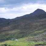 The writer of this blog on Todun focuses on its being part of the hills of North Harris and a peak that has attracted Rhenigidale hostellers. It is obvious that the summit provides views, but their extensiveness over The Pairc and out to The Shiants is impressive. This is what is said: It’s easy now Read More ...Read More »
155-Year Span
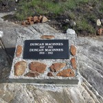 Here is a fine place to start research into family connections and to be in awe of the longevity of the two Duncans, members of the MacInnes family from 1827 – 1908 – 1982. Their presence in and around Rhenigidale has alerted the interests of at least two people in recent times. Tina MacInness was Read More ...Read More »
Seven Years On
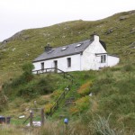 Blogs come and go, although some become almost electronic monuments to places and events. Robert Hawkins enjoyed a motor-cycle tour of Scotland in September 2006 and his photographs and descriptions remain posted here. He maintains that Rhenigidale was one of his favourite places and gives a description about the image, shown above, which arouses similar feelings Read More ...Read More »
Gary-Aloteger - in name only
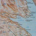 To the west of Rhenigidale, on the footpath towards the zig-zag lies Gary-Aloteger. Here’s something of its history: ‘Notes NB 2209 0184 A walkover survey was undertaken on 10 May 2009 in connection with the development of a potential woodland. Three clusters of buildings and related features associated with the small township of Gearraidh Lotaigear were Read More ...Read More »
Winter's Coming
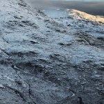 The evenings are closing in at around two minutes every 24 hours. When British Summer Time ends on Sunday morning next, the Winter will soon be with us. Take advantage of warmer conditions now or wait for the type of weather featured in this photograph of the Postman’s Path to Rhenigidale taken by Jerome Lorieau. Read More ...Read More »
The Sheriff's Nose
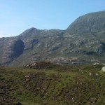 Here’s an account from a BBC website: ‘A view across Loch Trollamarig from above Molinginish. If you look closely left of centre, you can see a shadow cast against the hillside which looks like the profile of the face of a man with a prominent nose. The protruding ridge just to the left of this Read More ...Read More »
The Tale of a Trail - Part Two
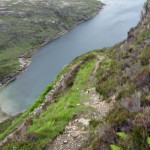 There are numerous routes to enjoy, but for the adventure of a change of height – a thousand feet in almost as many steps – follow the second instalment of the blog by Marc Calhoun. His photography captures something of the well-tracked trail. The view of Trollamarig Beach has incidental interest in that there was Read More ...Read More »
The Tale of a Trail - Part One
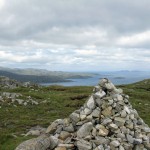 Here’s the first part of an account by Marc Calhoun of his journey from Urgha to Rhenigidale, a route that was planned in advance but where something thwarted progress. The photograph of the summit on the old Postman’s Path indicates a marker that matters – gradients certainly count for walkers – and a view that Read More ...Read More »
Follow The Independent
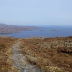 The summit has been reached after the steady climb from Urgha on the Tarbert to Scalpay road. Now the Postman’s Path begins its descent towards Rhenigidale. Mark Rowe made the journey, wrote about it for The Independent and his account appeared in the newspaper on Saturday 17 August 2013. It invites others to follow in Read More ...Read More »
From Harris With Love
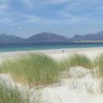 The BBC Alba programme – From Harris With Love – Episode Three will be available on iPlayer for the next four weeks (towards the end of October 2013) and is well worth seeing. The lives of several residents are featured, including that of Kate, whose work includes running the Tarbert Community Centre as well as Read More ...Read More »
Rhenigidale Shepherd
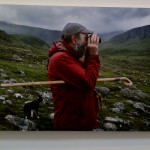 Photographs of Angus Campbell, a shepherd who crofts in the hills around Rhenigidale hostel, have appeared at @anlanntair (www.lanntair.com/) the arts centre in Stornoway. They give a graphic insight into the daily life of a shepherd and show many evocative landscapes round & about Rhenigidale. The photographs are the work of Dutch born artist Michel Szulc-Krzyzanowski (http://www.szulc.info/)Read More »
When the FT Covered Rhenigidale
 Most news and data that appear in the Financial Times do not concern the sort of business conducted in Rhenigidale. However, some four years ago the North Harris settlement and its surrounds appeared in an article in the FT which can be accessed. It assessed features of the history, location, facilities and appeal of a place that Read More ...Read More »
An Ultimate Gallery
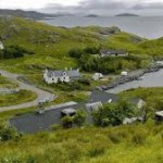 You may have stayed at or been in Rhenigidale on a number of occasions, but this collection of photographs from fluidr, the French equivalent of flickr, provides an Ultimate Gallery of sights in, from, above, around and beyond the settlement. They have those factors which compel either a visit or a return – for the Read More ...Read More »
Take the High Route
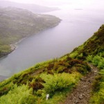 There are several ways of approaching Rhenigidale – with anticipation, interest, curiosity, relief or, perhaps, trepidation. It varies as to whether you are on foot, bicycle or in a car. Those who have come – or or considering – by the hill-routes should enjoy the blog, The Adventures of a Mountain Coward, and particularly the Read More ...Read More »
Going, Going ...
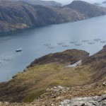 Settlements on the shores of islands were often once thriving, but with road improvements they became cut off and ready for abandonment. Up the Loch Seaforth coast from Rhenigidale was Nostar, and here its owner considered that the levels of fertility were sufficiently high for cultivation by tractor. This piece of machinery remains, but is going to disappear Read More ...Read More »
Looking Around
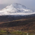 Rhenigidale is well located for those wanting to climb the highest peak in the Outer Hebrides, Clisham. At 2621′ it is in the Corbett category and, of course, affords fine views of Harris and Lewis. The photographs here are of a distance shot from Maaruig, along Loch Seaforth from Rhenigidale, and of the mountain’s summit. Read More ...Read More »
'Cute and Comfortable'
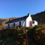 TripAdvisor has just one review of the Rhenigidale Hostel where it’s described as ‘cute and comfortable’ with a ‘friendly warden’. There’s obviously much more to be said about its facilities and location, but this is a good start for the first of the six Gatliff hostels that were established in the second half of the 20th Read More ...Read More »
A View from Down Under
 The Eagleton Notes come with a wide range of topics and are compiled by a Hebridean turned Kiwi. He resides in the Summers – whenever they are happening in New Zealand or in Scotland. However, he claims all-year-round residency in Blogland. He and his wife visited Rhenigidale four years ago and their observations are worth Read More ...Read More »
Back of the Hostel ... and Beyond
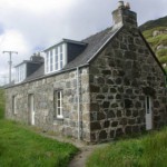 To many people, Rhenigidale is at the back of beyond, but to those who like to go that little further there is a 15 minute walk behind the hostel to Seaforth Cottage. It commands views of the entrance and extent of Loch Seaforth and of the completely unpopulated seashore of The Pairc, one of the largest Read More ...Read More »
Links to Remote Rhenigidale
 Despite its remoteness, Rhenigidale became in the forefront, at least from the latter part of the 20th Century, of telecommunications. Although at one time it had just one phone, that was linked to the wider system by radio which transmitted the signal to Gairloch, on the Mainland, and on to the exchange in Ullapool. Now Read More ...Read More »
Todun in Full
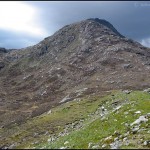 The peak close to Rhenigidale is Todun. At 1732′ high it is visible from across The Minch and is in that group of hills called ‘Marilyns’ that are beloved by those walkers who like categories. Their peaks must be over 492′ (150 metres) and stand out from other hills in the vicinity. There are 2009 Read More ...Read More »
Flickr For Filling with Fotos
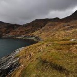 Every place and topic seems to have a gallery to itself on Flickr and Rhenigidale is no exception. However, the number of photographs on display within it is limited and could do with a boost. Here are two to browse and possibly to stimulate the expansion and variety of images. Cameras are always much in Read More ...Read More »
A Boundary Marker
 Loch Seaforth is an impressive sea-loch that divides Lewis and Harris. Once, before the Western Isles were granted unified local authority status, it marked the boundary between Ross & Cromarty and Inverness-shire. A short walk behind the Rhenigidale hostel takes you close to where the Loch meets The Minch. Here there is a holiday cottage where construction work Read More ...Read More »
Following in the Footsteps of the Postman
 Before the road was built to Rhenigidale, the postman made his deliveries by a well-defined path involving some arduous climbs en route to and from the Tarbert to Scalpay road. This and other paths in the district have been maintained and provide interest as well as exertions. Take a look at the WalkHighlands details and Read More ...Read More »
Domesday Recalled at Rhenigidale
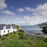 In 1986 extensive research was done to record aspects of everyday life in the United Kingdom. The data has been stored in the Domesday Project and can be retrieved. Here are the entries for Rhenigidale and they make interesting reading for the road had not yet reached the settlement then. The hostel, however, had been Read More ...Read More »
Driving Down to Rhenigidale
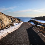 This video – Driving Down to Rhenigidale – will be an introduction for many and bring back memories for some, especially for those who have walked or cycled the road. Some will recall how remarkable it is that a metalled highway was ever driven there through and over the rocks in the first place, being completed Read More ...Read More »
Near and Yet So Far
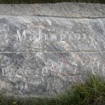 The settlement of Molinginish is relatively close to Rhenigidale by sea, although obscured by promontories. Walking there along the coast is hazardous and so the recommended route is to take the Urgha track up the zig-zag path and to turn left at the sign just below the summit. The former village consists of two restored Read More ...Read More »